DELTA Course – National and Kapodistrian University of Athens fulfilled the virtual F2F activities for Module 2
Module 2 was concluded on June 16-17, with Face-to-Face activities, which were carried out online due to the pandemic. These activities aimed at improving the knowledge gained by studying the learning materials, and they were structured in a way which combined theory and practical assignments. More specifically, students were trained on various tasks based on the knowledge gained during the course units Digital documentation in situ (M2.2) and Post-excavation analysis of digital archaeological data (M2.4) regarding the use of KoBoToolbox and QGIS software. After a detailed demonstration, learners had to individually practice specific tasks, by following the instructions of given handbook chapters and by completing step-by-step assignments.
F2F activities were mandatory for students from the National and Kapodistrian University of Athens, the Masaryk University and the University of Basilicata. All the other students were free to join the activities.
During the four-hour session of the first day, in June 16, students were trained on two different tasks based on the knowledge gained in unit M2.2. First, they created their own digital excavation forms for documentation in the field, by using the KoBoToolbox open-source software. Learners were more specifically trained on how to record and integrate various types of archaeological information, including general excavation data, soil description, visual records, and coordinates. The second activity involved the processing of the archaeological data recorded in KoBoToolbox Excavation Forms and the export of the collected data as XLS files, which included different types of information (text, photos, coordinates). Forty (40) students participated in the activities of the first day.
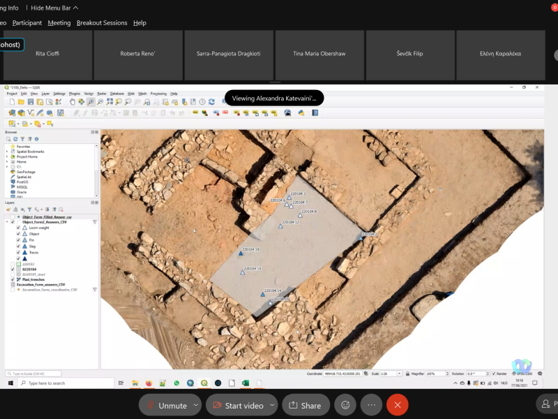
During the four-hour session of the second day, in June 17, students were engaged in four interrelated activities based on the knowledge gained in unit M2.4. During the first, one-hour session, students were trained on how to import and georeference an excavation orthophoto in QGIS. The following activity focused on how to import excavation data in QGIS, and the third on how to import excavation finds in QGIS. During the last session, students were trained on how to export maps from QGIS, in order to include them in presentations and publications. Forty one (41) students participated in these activities.
During and after the completion of these activities, students had the opportunity to pose questions and share their experience with the tutors.
Face-to-face activities provided students the opportunity to be actively engaged with digital tools whose methodology and use is essential knowledge for the execution of various tasks during and after excavation, such as accurate and consistent documentation in the field, post-excavation processing, analysis, management and presentation of the collected digital data, and finally interpretation of the archaeological evidence.


